


randonnée nordique

Bernadette Noirant
User
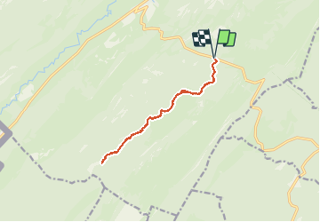

Length
11.6 km

Max alt
1461 m

Uphill gradient
254 m
Km-Effort
15 km

Min alt
1302 m

Downhill gradient
254 m
Boucle
Yes
Creation date :
2021-01-26 09:54:47.649
Updated on :
2021-01-26 18:16:00.206
5h01
Difficulty : Very easy

FREE GPS app for hiking
 SityTrail
IGN / Geographical institutes
SityTrail Plus
The world is yours!
About
Trail Touring skiing of 11.6 km to be discovered at Vaud, District du Jura-Nord vaudois, Le Chenit. This trail is proposed by Bernadette Noirant.
Positioning
Country:
Switzerland
Region :
Vaud
Department/Province :
District du Jura-Nord vaudois
Municipality :
Le Chenit
Location:
Unknown
Start:(Dec)
Start:(UTM)
288165 ; 5160608 (32T) N.
Comments